Navigating Route 66: Maps, Apps, Signs, and How to Stay on the Historic Alignment
Route 66 is not a single road. It never has been. Over the sixty years the highway was officially designated — from its commissioning on November 11, 1926 to its decommissioning in 1985 — Route 66 was rerouted multiple times in every state, creating overlapping historical alignments that today exist as county roads, frontage roads, business routes, and state highways running alongside or beneath Interstate 40. Navigating the historic alignment — the original, two-lane Route 66 that defines the experience — means knowing which of these roads is the real one at any given point, and that knowledge does not come from Google Maps.
This is the navigation challenge that defines Route 66 as a road trip: you are not simply following a single highway from A to B. You are reconstructing a road — piecing together sections of pavement from different eras, following brown historic highway signs, consulting turn-by-turn guidebooks, and occasionally making a judgment call at a rural intersection with no service and three roads heading in different directions. It sounds difficult. It is actually one of the most rewarding parts of the trip. And with the right tools — described in this guide — it is entirely manageable even for first-time Route 66 travelers.
This guide covers everything you need to navigate Route 66 successfully: the best maps and apps for every situation, the signs to watch for in every state, how to handle dead zones with no cell service, and a state-by-state alignment guide for the specific navigation challenges and key turns in each of the eight Route 66 states.
The Core Navigation Challenge: What Makes Route 66 Different

Most GPS navigation applications — Google Maps, Apple Maps, Waze — are designed to get you from point A to point B by the fastest, most direct route available. They do not know that the frontage road running parallel to I-40 is historic Route 66. They do not know that the correct Route 66 turn in Albuquerque is onto Central Avenue rather than the on-ramp to the interstate. They do not know that the old road through Seligman, Arizona is the road worth taking even though I-40 is faster. Left to their own routing logic, GPS applications will put you on the interstate every single time
The result, for travelers who rely exclusively on standard GPS navigation, is a trip that covers the correct miles between the correct cities but misses most of what makes Route 66 worth driving. The iconic roadside architecture, the two-lane alignment curves through the Ozarks, the Painted Desert at sunrise, the neon motel signs of Tucumcari — all of these require leaving the interstate and navigating the historic alignment. Doing that reliably requires tools that understand Route 66 specifically, not just roads generally.

Three Types of Navigation Situations on Route 66
Understanding the three distinct navigation situations on Route 66 helps you choose the right tool for each:
- Urban sections: Chicago, St. Louis, Springfield (IL), Oklahoma City, Amarillo, Albuquerque, Flagstaff, and the Los Angeles basin. Cell service is strong, landmarks are dense, and the historic alignment is usually well-marked on major streets. Standard GPS apps work adequately here, though the EZ66 guide still provides the correct historic alignment through city centers.
- Town-to-town corridor sections: The stretches between towns — Illinois farmland, Missouri Ozarks, Oklahoma two-lanes, Texas Panhandle, New Mexico high desert. Cell service is variable. The historic alignment often runs as a frontage road or county road parallel to I-40. Brown Historic Route 66 signs are the primary navigation aid, supplemented by the EZ66 guide and offline maps.
- Remote dead-zone sections: The New Mexico stretches west of Albuquerque, the Arizona sections through Seligman, Hackberry, and east of Kingman, and the California Mojave through Amboy and Ludlow. Cell service is absent for extended stretches. Physical guidebooks and pre-downloaded offline maps are the only reliable navigation tools.
Navigation Tools: What to Use and When
The ideal Route 66 navigation stack uses multiple tools in combination — a physical guidebook as the primary alignment reference, offline maps as the GPS backbone, a dedicated Route 66 app for context and commentary, and standard GPS apps for urban sections and service finding. No single tool covers every situation. Here is an honest comparison of every option.
| Navigation Tool | Works Offline | No Cell Service | RT66 Alignment Aware | Best Use on Route 66 |
| EZ66 Guide (Jerry McClanahan) | ★★★★★ | ★★★★★ | ★★★★★ | The definitive Route 66 navigation resource. A physical book with turn-by-turn directions for every historic alignment from Chicago to Santa Monica. Works with zero technology. Every serious Route 66 driver carries it. Does not provide real-time info but is unmatched for alignment accuracy. Buy before you leave. |
| Route 66 Roadside Adventure App | ★★★★☆ | ★★★★☆ | ★★★★★ | Dedicated Route 66 app with GPS-triggered audio commentary, attraction markers, and alignment tracking. Works offline with pre-downloaded content. One of the best digital companions for the trip — it tells you about landmarks as you approach them, which is impossible with a general navigation app. |
| Google Maps (offline download) | ★★★★☆ | ★★★★☆ | ★★☆☆☆ | Essential for general navigation but does not know the Route 66 historic alignments. Will route you onto I-40 by default. Use for: finding specific addresses, locating gas stations, motels, and restaurants, and as a backup navigation when other tools fail. Download offline maps for each state before departure. |
| Maps.me (offline) | ★★★★★ | ★★★★★ | ★★★☆☆ | Excellent offline mapping with full functionality without cell service. Better than Google Maps for dead-zone navigation. Download maps for all 8 Route 66 states before departure. Does not specifically recognize Route 66 alignments but provides reliable navigation for the road names the alignments follow. |
| Waze | ★★★★☆ | ★☆☆☆☆ | ★★☆☆☆ | Excellent for real-time traffic and hazard alerts in urban areas (Chicago, St. Louis, Albuquerque, LA). Requires constant cell service. Not appropriate as a primary navigation tool for the rural sections. Use specifically for the Chicago approach and the LA basin final section where traffic matters most. |
| Apple Maps (offline) | ★★★☆☆ | ★★★☆☆ | ★★☆☆☆ | Adequate backup option for iPhone users. Offline functionality has improved but remains inferior to Google Maps or Maps.me for dead-zone use. Not Route 66 alignment-aware. Useful for general navigation and finding services in larger towns. |
| GasBuddy | ★★★★★ | ★☆☆☆☆ | N/A | Not a navigation tool but an essential Route 66 budget companion. Shows real-time gas prices at stations near your location. Invaluable for the Oklahoma→New Mexico and Arizona→California fuel-strategy decisions. Requires cell service — check before entering dead zones. |
| Printed state highway maps | ★★★★★ | ★★★★★ | ★★★☆☆ | Paper maps from state DOTs or AAA provide a reliable backup that never runs out of battery and never loses signal. Carry one per state. Available free at state welcome centers when you cross each state line — one of the best reasons to stop at welcome centers. |
The EZ66 Guide: Why It Is Irreplaceable
The EZ66 Guide for Travelers by Jerry McClanahan is the most important navigation tool for a Route 66 trip, and the one most commonly underestimated by travelers who assume their phone is sufficient. Published in updated editions that track changes to the alignment, the EZ66 is a spiral-bound, waterproof-page physical book that provides turn-by-turn directions for every section of historic Route 66 alignment — including the multiple-alignment sections in Missouri and Oklahoma where the correct historical road requires knowledge that no GPS application possesses.
What makes the EZ66 irreplaceable is not just its alignment accuracy but its operating assumptions: it assumes you are on the historic alignment, describes landmarks as they appear from the road while traveling west (or east in the eastern edition), and provides the specific turn instructions that allow you to stay on the old road rather than defaulting to the interstate. It works with zero battery, zero cell signal, and zero internet connectivity — making it the only navigation tool that is fully reliable in the most remote sections of the route. Buy it before you leave. Use it as your primary reference and supplement it with everything else.
Building Your Offline Map Stack

The offline map preparation for a Route 66 trip should be done before you leave home, not when you are already in a dead zone. Here is the recommended preparation sequence:
- Google Maps: Open Google Maps, search for each state along Route 66, and download the offline map for each state. Do all eight states. The downloads are large (500MB–2GB per state) — do this on Wi-Fi, not cellular data.
- Maps.me: Download the Maps.me app and download offline maps for all eight Route 66 states. Maps.me is superior to Google Maps for areas with limited data because it uses OpenStreetMap data that often has more detail on rural roads.
- Route 66 specific app: Download and cache content from whichever dedicated Route 66 app you choose before departure. Most Route 66 apps require an initial data download to function offline.
- Test everything: Put your phone in airplane mode and test that your offline maps load and navigate correctly before you leave home. The middle of the New Mexico desert is not the place to discover that your offline download failed.
Route 66 Road Signs: A Complete Field Guide
Learning to read the Route 66 road sign system is a fundamental navigation skill. The signs vary by state, by era, and by the organization that installed them — understanding the differences prevents wrong turns and missed sections. Here is everything you need to know about the signs you will encounter.
The Historic Route 66 Shield
The primary Route 66 navigation marker is the Historic Route 66 highway shield — a black-and-white (or occasionally color) version of the original Route 66 shield design, mounted on standard highway sign posts. These shields mark turns onto and along the historic alignment in most states. They are the single most important sign to recognize and follow.
Key facts about the historic shields:
- They are not consistent across state lines. Each state manages its own historic highway signage program, and the appearance, frequency, and accuracy of the shields varies significantly. Oklahoma and Arizona have the best historic sign systems; Missouri and New Mexico are patchier.
- They are sometimes missing at critical turns. Vandalism, theft (the shields are popular souvenirs), and deferred maintenance mean that critical turn markers occasionally disappear for extended periods. This is exactly why the EZ66 guide is essential — it documents the turns that signs should mark, regardless of whether the sign is currently present.
- They mark the alignment, not necessarily the ‘best’ alignment. In states with multiple historical alignments, the current signs may follow a particular era’s alignment rather than the oldest original road. The EZ66 guide notes where multiple alignments exist and which options are currently driveable.
Brown Historic Highway Signs

In addition to the Route 66 shields, brown rectangular highway signs reading “Historic Route 66” (with or without the shield icon) mark the alignment in many states. These brown signs follow the national standard for historic and cultural highway designations and are often the most visible navigation aid on long stretches of the route. They appear at intersections, on approach to towns, and periodically on straight stretches to confirm you are still on the correct road.
Brown sign reliability by state:
- Illinois: Well-signed throughout the corridor with brown Historic Route 66 markers.
- Missouri: Present in major sections but inconsistent in the Ozark rural stretches. Do not rely on brown signs alone in Missouri.
- Kansas: Well-signed for its 13-mile length. No navigation challenges.
- Oklahoma: Generally well-signed but with gaps in the oldest alignment sections. The eastern Oklahoma corridor between Vinita and Claremore requires attention.
- Texas: Well-signed through the Panhandle. The Business I-40 signs through Amarillo effectively double as Route 66 markers.
- New Mexico: Patchy and unreliable west of Albuquerque. Do not attempt New Mexico without the EZ66 guide or a Route 66 app.
- Arizona: Among the best sign systems on the route. The SR-66 designation through the preserved sections (Seligman, Hackberry, Kingman) provides clear navigation in the most scenic state.
- California: Blue and white California Historic Route 66 signs in the LA basin corridor from San Bernardino to Santa Monica are clear and reliable.
Business Route Signs
Many Route 66 towns have “Business Route” signs that direct travelers through the old commercial main street rather than the bypass. When you see a Business Route sign, take it — the main street alignment is almost always the historic Route 66 alignment through town, and these main streets are where the diners, historic buildings, and roadside attractions are located. A business route sign in an Oklahoma or Arizona town is a reliable indicator of the authentic Route 66 experience.
Blue and White California Historic Route 66 Markers
The California section of Route 66 uses a distinct blue and white rectangular sign reading “Historic Route 66” in the Los Angeles basin corridor. These California markers are particularly reliable in the final approach to Santa Monica — from San Bernardino through Fontana, Rancho Cucamonga, Upland, Claremont, Pomona, Glendora, Azusa, Arcadia, Monrovia, and Pasadena, the blue California Historic Route 66 signs guide you along Foothill Boulevard and Colorado Boulevard with impressive consistency.
What to Do When You Miss a Turn

Missing a Route 66 turn is universal — every traveler does it at some point. Here is the correct procedure:
- Do not panic or make an abrupt U-turn. Pull over safely and consult the EZ66 guide or your offline map. The missed turn is usually very close behind you and easy to re-enter.
- Look for frontage roads. In the I-40 corridor states, if you accidentally got on the interstate, the historic Route 66 alignment is almost certainly the frontage road visible alongside or just below the interstate. Take the next exit and look for the frontage road.
- Orient using landmarks. The EZ66 guide describes landmarks visible from the road — a specific building, a sign, a bridge, a bend in the road — that tell you where you are on the alignment. Use these to reorient after a missed turn.
- It is OK to skip a section. Some alignments are badly deteriorated, privately owned, or impassable. The EZ66 guide notes which sections are currently unnavigable. Skipping a broken section to rejoin the alignment at the next available point is normal and expected.
Cell Service State by State: Where to Expect Dead Zones
Cell service on Route 66 follows a predictable pattern: strong in urban corridors, variable in rural sections, absent for extended stretches in New Mexico and Arizona. Understanding exactly where coverage drops allows you to prepare — downloading offline maps, checking conditions, and communicating with anyone who needs to know your status — before you enter the dead zones, not after.
| State | Overall Coverage | Dead Zone Risk | Navigation Strategy for Each State |
| Illinois | STRONG | Minimal | Chicago metro and the Illinois corridor are well-covered. The rural southern Illinois sections may have occasional weak signal. Cell service is reliable enough that offline maps are a convenience, not a necessity, for most of Illinois. |
| Missouri | GOOD | Occasional | St. Louis and larger towns are well-covered. The Ozark two-lane alignments — the most scenic driving in Missouri — pass through forested hills where signal drops or disappears for 15–30 miles at a stretch. Download offline maps for the Ozark corridor before entering. |
| Kansas | GOOD | Minimal | Only 13 miles — cell coverage is adequate throughout. The short length means dead zones are not a practical concern. |
| Oklahoma | MODERATE | Frequent on 2-lane | Oklahoma City and Tulsa have strong coverage. The historic two-lane alignments through eastern Oklahoma — the most authentic Route 66 driving in any state — pass through rural stretches with inconsistent signal. The alignment between Afton, Vinita, and Chelsea is particularly spotty. Offline maps are essential. |
| Texas | MODERATE | Rural gaps | Amarillo has full coverage. The Panhandle stretches between towns can have weak signal on the historic alignment. The exposed flatland actually helps — towers are often visible from a great distance, and brief dead zones resolve quickly. |
| New Mexico | POOR–MODERATE | Significant & frequent | New Mexico has the most extensive dead zones on the entire route. Albuquerque and Gallup have full coverage, but the historic alignment between Tucumcari and Santa Rosa, and the long stretches west of Albuquerque through Cubero, Budville, and Thoreau to the Arizona line, can have 30–50 mile gaps with no signal. Offline maps are critical. Download before leaving Tucumcari or Albuquerque. |
| Arizona | POOR–MODERATE | Significant & frequent | Flagstaff and Kingman have full coverage. The historic alignments through Seligman, Peach Springs, Hackberry, and the stretch between Kingman and Oatman have significant dead zones. The Two Guns ghost town area and sections of the Painted Desert / Petrified Forest corridor also drop signal. Offline maps and the EZ66 Guide are both essential. |
| California | VARIABLE | Mojave dead zones | The Los Angeles basin, Pasadena, San Bernardino, and the urban corridor to Santa Monica have excellent coverage. The Mojave Desert section — particularly between Amboy and Ludlow on the historic alignment — has significant dead zones in the most remote California stretch. Needles has coverage. Download offline maps before leaving Needles heading west. |
What to Do in a Dead Zone
Standard protocol for entering known dead zones on Route 66:
- Before entering: Check offline maps are loaded, download any information you will need (motel address, next fuel stop, current road conditions), and notify someone of your route and ETA.
- In the dead zone: EZ66 guide + offline maps are your navigation system. Trust them. The paper guidebook has navigated hundreds of thousands of travelers through the same sections without a signal.
- Emergency communication: A satellite communicator (Garmin inReach, SPOT, or Apple Satellite SOS on iPhone 14+) provides emergency communication capability even with no cellular signal. For solo travelers and motorcyclists on Route 66, the investment is worth serious consideration.
- After the dead zone: Reconnect and send any queued messages as soon as signal returns. Text updates from a Route 66 trip tend to arrive in batches from dead zone exits, which your contacts will quickly learn to expect.
State-by-State Alignment Navigation Guide
The table below provides the specific navigation notes, key turns, and alignment challenges for each of the eight Route 66 states. Use this alongside the EZ66 guide and your state-specific offline maps as you plan and drive each section. For detailed coverage of attractions, history, and stops in each state, see the individual state guides linked at the end of this article.
| State | Alignment Navigation Notes — Key Turns, Signs, and Challenges |
| Illinois | The Illinois alignment is well-marked with brown Historic Route 66 signs for most of the corridor from Chicago to the Missouri line. The primary navigation challenge is the Chicago start: the Begin sign is at Adams Street and Michigan Avenue in downtown Chicago — follow the signed Historic Route 66 trail southwest through the city. The Illinois alignment runs through Joliet, Wilmington (Gemini Giant), Dwight, Pontiac, Bloomington, Springfield, Auburn, Litchfield, and Mt. Olive. Several bypasses around larger towns put you on the four-lane alignment rather than the original two-lane — the EZ66 guide specifies which turns to make to stay on the older road. |
| Missouri | Missouri has multiple overlapping Route 66 alignments from different eras — in some sections there are three or four different roads that were each officially Route 66 at some point. The EZ66 guide is essential here. The Chain of Rocks Bridge (original Mississippi crossing) requires a short detour from St. Louis but is worth every foot. The Ozark two-lane alignments between Sullivan and Joplin are the navigational heart of Missouri — slow down, follow the brown signs, and take every turn the guide recommends. The Cuba mural district is on the old alignment through town rather than the bypass. |
| Kansas | Just 13.2 miles — enter at Galena from the Oklahoma border, drive through Galena (stop at Cars on the Route), Riverton, and cross the Rainbow Curve Bridge before entering Oklahoma. Brown Route 66 signs are present throughout. The easiest state to navigate on the entire route. |
| Oklahoma | Oklahoma has more original, intact Route 66 alignment than any other state — approximately 400 miles — and correspondingly more navigation complexity. Brown Historic Route 66 signs mark most of the corridor, but the density of intersections, bypasses, and historical alignments through the older stretches between Tulsa and Oklahoma City requires the EZ66 guide. Key navigation points: the Blue Whale in Catoosa (easy to miss if not watching for it), the alignment through Arcadia around Pops 66, the Turner Turnpike bypass (stay on the historic road, not the toll road), and the transition through Oklahoma City. The western Oklahoma section from Clinton to Erick is beautifully preserved and well-marked. |
| Texas | The Texas Panhandle alignment is relatively straightforward — it largely follows US-66 / Business I-40 through Shamrock, McLean, Alanreed, Groom (leaning water tower), Conway, Amarillo, and Adrian. Cadillac Ranch is on the south frontage road of I-40 west of Amarillo — it is not visible from the interstate and requires turning onto the frontage road. The Midpoint Café in Adrian is directly on the alignment through town. The Texas alignment west of Amarillo to the New Mexico line is well-marked with brown signs. |
| New Mexico | New Mexico is the navigation state that most surprises travelers. The historic alignment is often a frontage road running parallel and very close to I-40 — distinguishable only by the texture of the road surface and the age of the structures alongside it. Watch carefully for the brown Historic Route 66 signs, particularly between Santa Rosa and Albuquerque. In Albuquerque, the alignment follows Central Avenue through the entire city — one of the longest urban stretches of original Route 66 in the country and one of the most rewarding. West of Albuquerque through Corrales, Cubero, and Grants, the road periodically crosses under or over I-40 — follow the EZ66 guide and brown signs carefully. |
| Arizona | Arizona is the navigational showpiece of Route 66. The historic alignment separates most dramatically from I-40 in this state — through Petrified Forest, Winslow (Standin’ on the Corner), Flagstaff, Williams, Seligman, Hackberry, Kingman, and the mountain road to Oatman. The Petrified Forest section requires entering the park (fee) to access the historic alignment; the EZ66 guide provides the bypass option. The Oatman road (old alignment over Sitgreaves Pass) diverges from I-40 at Kingman — take SR 66 / Oatman Road west for the most spectacular and authentic Route 66 driving in any state. Do not miss the turn. |
| California | California’s alignment begins at the Colorado River crossing into Needles and runs through the Mojave on National Trails Highway / Route 66 through Goffs Road, Essex, Amboy (Roy’s Motel and Café — the most photographed building in the Mojave), Ludlow, Newberry Springs, Barstow, and Victorville before climbing into the San Bernardino mountains through Cajon Pass. The descent from Cajon Pass and the transition through San Bernardino, Fontana, Rancho Cucamonga, Upland, Pomona, and into the Los Angeles basin follows Foothill Boulevard and then Colorado Boulevard through Pasadena. The final section through the LA basin to the Santa Monica Pier follows Santa Monica Boulevard and Ocean Avenue — well-marked with blue and white California Historic Route 66 signs in this final corridor. |
The Most Commonly Missed Sections — and How to Catch Them
These are the sections of Route 66 that travelers most frequently skip, miss, or drive incorrectly — usually because a sign is missing, a GPS defaults to the interstate, or the alignment is not intuitive. If you only consult this guide for a few specific locations, make it these.
The Chain of Rocks Bridge, Missouri
The original Route 66 crossing of the Mississippi River — a 1929 bridge with a distinctive 22-degree mid-span turn — is not visible from I-270 and is not signposted from the interstate. To find it: take the Riverview Drive exit from I-270 north of St. Louis, follow the signs for Missouri‘s Chain of Rocks Road. The bridge is open to pedestrians and cyclists (no vehicle traffic) but is a mandatory stop — the view of the Mississippi and the bridge’s unique geometry is one of the great Route 66 experiences. The EZ66 guide has precise directions.
Cadillac Ranch, Texas
Cadillac Ranch is on the south frontage road of I-40, approximately 4 miles west of Amarillo on the westbound side. From the interstate, it is not visible. Take exit 60 (Arnot Road) westbound, turn onto the south frontage road, and look for the gravel parking area. The ten half-buried Caddies are in an open field about 300 feet from the road. There is no formal signage from the interstate — the frontage road is the Texas Route 66 historic alignment, and the Cadillac Ranch turn is marked only by informal online maps and the EZ66 guide.
The Painted Desert and Petrified Forest, Arizona
The Petrified Forest National Park alignment section requires entering the park at the north entrance off I-40 at exit 311, driving south through the park, and exiting at the south entrance onto US-180 heading toward Holbrook. This section of Route 66 runs through the park — you cannot experience it without paying the park entry fee. The Painted Desert is accessible from the park’s northern visitor center. The EZ66 guide documents the bypass option (straight on I-40 to Holbrook) for travelers who choose not to enter the park, but the inside alignment is the correct historic road and by far the more rewarding option.
The Oatman Road, Arizona (Sitgreaves Pass)
The Oatman Road — old Route 66 over Sitgreaves Pass — branches from I-40 Business/SR-66 in Kingman heading northwest on Oatman Road. This is the most frequently missed major section on the entire route. GPS navigation defaults to I-40, which bypasses Oatman entirely. To take the historic alignment: from Kingman, follow Andy Devine Avenue (the business route through town) northwest, then turn onto Oatman Road heading toward the Black Mountains. The road climbs through dramatic switchbacks to Sitgreaves Pass before descending into Oatman — the old gold-mining town famous for its wild burros on the main street. Do not skip this section.
The Amboy to Ludlow Stretch, California Mojave
The California Mojave alignment between Needles and Barstow follows National Trails Highway — an unnumbered road that runs parallel to I-40 through the most remote landscape on the entire route. The key stop is Roy’s Motel and Café in Amboy — one of the most photographed buildings on Route 66, the neon Roy’s sign visible from miles away across the flat Mojave. The turn from I-40 onto National Trails Highway is at Needles — follow the Historic Route 66 signs. Once on this road, GPS is unreliable and cell service is absent for long stretches. Carry the EZ66 guide and offline maps for this section.
The Los Angeles Basin Final Approach
The last 60 miles of Route 66 — from San Bernardino through the Inland Empire and Los Angeles basin to Santa Monica — is where the most travelers get lost, not because navigation is difficult but because Los Angeles traffic is disorienting and the route passes through dozens of municipalities, each with their own road signage. The historic alignment follows: Foothill Boulevard from San Bernardino through Fontana, Rancho Cucamonga, Upland, Claremont, Pomona, Glendora, Azusa, Duarte, Irwindale, Baldwin Park, El Monte, Arcadia, and Monrovia; then Colorado Boulevard through Pasadena and into the City of Los Angeles; then Santa Monica Boulevard through Hollywood and West Hollywood into Santa Monica; then Ocean Avenue to the Santa Monica Pier. Blue California Historic Route 66 signs mark much of this corridor, but use your offline maps and the EZ66 guide for the transitions between street names.
Navigation Strategy: First-Time vs. Experienced Route 66 Travelers
For First-Time Route 66 Travelers
The recommended navigation setup for someone driving Route 66 for the first time:
- Buy the EZ66 guide and read the introduction section before you leave. Mark the key turns in each state with sticky tabs.
- Download offline maps for all eight states in both Google Maps and Maps.me before departure.
- Download a dedicated Route 66 app and cache content while on Wi-Fi at home. The GPS-triggered commentary makes every mile more meaningful.
- Follow the signs first, the phone second. When you see a Historic Route 66 brown sign pointing left, turn left — even if your GPS says to continue straight.
- Budget extra time at every state line. Stop at the welcome centers — they have free paper maps and staff who know the Route 66 alignment through their state.
- Accept that you will miss some sections. Every first-time Route 66 driver misses sections they later wish they had found. It is one of the reasons people come back.
For Experienced and Repeat Route 66 Travelers
Experienced drivers who have the basic navigation handled can focus on deeper exploration:
- The alternate alignments: Missouri has pre-1936 alignments through the Ozarks that predate the better-known road. Oklahoma has multiple era alignments between Tulsa and Oklahoma City. The EZ66 guide notes these — seek them on return trips.
- The unnavigable sections: Some original Route 66 alignment is on private land, unpaved, or deteriorated beyond use. Research which sections have recently become accessible (some have been reclaimed by local preservation groups) and which are still closed.
- The towns that most travelers drive through: On a first trip, you hit the major stops. On a second trip, you find what is between them — the town of Staunton, Illinois; the village of Newkirk, New Mexico; the ghost town of Goffs, California. These require the EZ66 guide and time.
Navigation and the Route 66 Centennial (2026)
The Route 66 Centennial — the 100th anniversary of the highway’s commissioning on November 11, 2026 — will affect navigation in a few specific ways:
- New signage installations: Several states are upgrading their Route 66 historic sign systems in preparation for the Centennial. New Mexico and Missouri, which have had the most inconsistent signage, are known to be adding markers. Navigation may be easier in 2026 than in prior years in these states — but do not count on new signs alone.
- Organized group drives: Centennial year will see large organized convoys traveling the route. If you encounter a Route 66 caravan, they are almost certainly on the historic alignment — they are a reliable visual navigation aid.
- Event-related traffic rerouting: Major Centennial events in Albuquerque, Oklahoma City, and Chicago may affect normal routing through those cities. Check event calendars at Route 66 Centennial 2026 before finalizing your route through major urban sections.
More Route 66 Trip Planning Resources
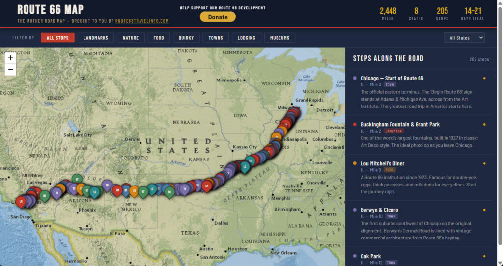
Route 66 — Complete Travel Guide — The full overview of all 2,448 miles: history, alignments, and what to expect in every state.
Best Time of Year to Drive Route 66 — Season affects road conditions on the historic alignment — monsoon flooding in New Mexico, snow closures in Arizona.
How Long Does It Take to Drive Route 66? — More days means more time to stop and explore the sections this guide describes. Do not rush them.
East to West or West to East? — Direction affects how you approach every key navigation point described in this guide.
Budgeting for a Route 66 Road Trip — Fuel strategy for each state — complements the cell service and dead zone guidance here.
Route 66 Packing List & Vehicle Prep Checklist — Includes specific navigation tool packing recommendations — EZ66 guide, offline maps, and the portable battery pack to keep your phone alive in dead zones.
Route 66 in Illinois — Detailed alignment guide for the first state, including the Chicago Begin sign location and the turn-by-turn corridor to the Missouri line.
Route 66 in Missouri — The most navigationally complex state for multiple historical alignments. Chain of Rocks Bridge directions included.
Route 66 in Kansas — Just 13 miles. Straightforward navigation; the Rainbow Curve Bridge and Galena are the key stops.
Route 66 in Oklahoma — 400 miles of original alignment with the greatest navigation depth of any state. Blue Whale, Pops 66, Totem Pole Park.
Route 66 in Texas — Cadillac Ranch frontage road access, the midpoint at Adrian, and the Panhandle alignment.
Route 66 in New Mexico — Highest dead zone risk on the route. Tucumcari neon, Albuquerque’s Central Avenue, Gallup.
Route 66 in Arizona — The Oatman Road, Petrified Forest alignment, and the preserved corridor from Seligman to Kingman.
Petrified Forest National Park and the Painted Desert — Entry and alignment instructions for the park section of Route 66.
Route 66 in California — Needles through the Mojave, Roy’s in Amboy, the Inland Empire, and the LA basin final approach to Santa Monica.
Route 66 Centennial 2026 — The 100th anniversary on November 11, 2026. Event calendar affecting urban routing through Chicago, Albuquerque, and Oklahoma City.
Route 66 State Associations — The eight state associations are the best local source for current alignment conditions, seasonal closures, and new signage.