Route 66 Sidewalk Highway: Driving the Nine-Foot Ribbon Road Near Miami, Oklahoma
| ⚠ TRAVELER’S NOTICE: CHECK CONDITIONS BEFORE YOU VISIT The Sidewalk Highway has been at the center of an active preservation debate between Ottawa County, the Oklahoma Department of Transportation, and Route 66 advocates. Sections of the road are rough, have missing pavement, and condition can change. Before driving either section, check current access status at oklahomaroute66.com/ribbon or contact the Oklahoma Route 66 Association directly. |
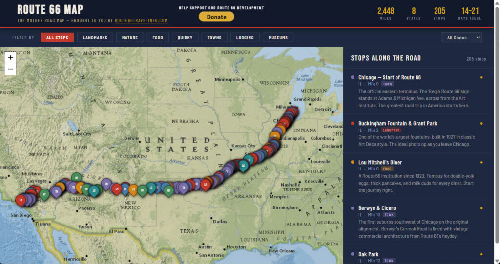
Most of Route 66 has been widened, straightened, resurfaced, or bypassed beyond recognition. But southwest of Miami, Oklahoma, an extraordinary relic of the highway’s earliest years survives: a narrow strip of nine-foot-wide pavement — barely wider than a modern driveway — that predates Route 66’s official designation by four years and stands today as the only surviving section of nine-foot original Route 66 pavement anywhere on the 2,448-mile Mother Road. Known by two names that capture its strangeness in equal measure — the Ribbon Road and the Sidewalk Highway — this is one of the most evocative and historically significant stretches of pavement in American road history.
Driving the Sidewalk Highway is an experience that Route 66 travelers consistently describe as genuinely moving. At nine feet wide — roughly the width of a modern suburban sidewalk or a single parking space — the road imposes a pace and an intimacy that no other surviving piece of Route 66 can match. The concrete curbs that edge the pavement on both sides are original 1922 construction. The flat Oklahoma farmland stretching away on either side has changed very little since early motorists crept along this strip of asphalt behind their Model Ts. The six sharp 90-degree turns of the original alignment feel like driving through a different era of engineering logic. This is what the road looked like before Route 66 existed as a concept.
This guide covers the complete story of the Sidewalk Highway: how it was built, why it is nine feet wide, what happened to it over the decades, the fight to preserve what remains, how to find and drive the surviving sections safely, and how it fits into a broader Route 66 in Oklahoma itinerary. The Sidewalk Highway is a free stop, it is unlike anything else on the Mother Road, and it is increasingly at risk — all of which makes it essential for any serious Route 66 traveler.
The Origin Story: How the Sidewalk Highway Was Built
Federal Aid Project No. 8: The Decision to Build
The Sidewalk Highway’s story begins not in 1926, when Route 66 was commissioned, but in 1918, when the federal government approved Federal Aid Highway Project No. 8 — a plan to pave a road connecting Miami and Afton, Oklahoma, a distance of approximately 15 miles through Ottawa County farmland. The project was approved on December 8, 1918, and construction was divided into two stages. The first stage linked Miami and the small community of Narcissa; work began in July 1919 and was completed in March 1921. The second extended the road from Narcissa to Afton; grading began in July 1921, and the surface was completed in February 1922. The completed segment ran 15.46 miles from Miami to Afton and was designated as part of Oklahoma State Highway 7.
The contractor was the Western Paving Company, which built the road with a five-inch concrete base, two inches of Topeka asphalt surface, and low concrete curbs on both sides. The Topeka asphalt — a mix of aggregate and bituminous cement whose formula had emerged from a patent dispute resolved in Topeka, Kansas — was the modern road-building standard of its era. The pale grayish-white concrete curbs that still run along both edges of the surviving pavement are original 1922 construction and are among the most distinctive visual features of the road today.
Why Nine Feet Wide? The Legend and the Reality
The nine-foot width of the Sidewalk Highway is the detail that defines it — and the question every visitor asks. A standard modern traffic lane is 10 to 12 feet wide; the Sidewalk Highway’s nine-foot pavement is narrower than a single lane of contemporary road. How did a state build a public highway at this width?
The most widely told explanation — and the one repeated by the Oklahoma Route 66 Association, the Miami Convention and Visitors Bureau, and generations of Route 66 writers — is a story of budgetary constraint and practical logic. Oklahoma was barely a state when the project was approved (it had entered the union only in 1907), and highway funds were scarce. When engineers were faced with a budget that could fund either a standard-width road for roughly half the distance between Miami and Afton, or a nine-foot-wide road for the full 15 miles, they chose coverage over width. The reasoning: in 1918–1922, automobiles were still relatively rare. When two cars met on a one-lane road, both would simply ease their outer wheels onto the gravel shoulders and pass each other. A road that reached all the way to Afton was more valuable than a wider road that stopped halfway.
The historical record is more nuanced. Contemporary news reports from the construction period describe variable widths along the route — the first mile and a half south of Miami was actually built at 18 feet wide before narrowing to nine. The actual reasons for the narrower sections are not fully documented, and the surviving paper trail suggests that the nine-foot width was partly a function of the Topeka asphalt mix used (which required specific aggregate handling), partly budget, and partly the traffic volumes anticipated for a rural Oklahoma county road in the early 1920s. The legend of “half the width, full the distance” captures the spirit of the decision even if the engineering reality was somewhat more complicated.
What is not disputed: the road was brilliantly constructed for its era. More than 100 years after completion, the surviving pavement is rough and pitted but fundamentally intact — a testament to the quality of the five-inch concrete base and Topeka asphalt surface. The Oklahoma Route 66 Association has noted that the makeup of the Sidewalk Highway’s pavement is unlike any other roadbed along Route 66 — a one-of-a-kind engineering artifact as well as a historical one.
From State Highway 7 to Route 66: 1922–1926
When the United States government created the numbered federal highway system in 1926, the committee drafting the new routes incorporated existing state roads wherever possible. Ottawa County’s State Highway 7 — including the Sidewalk Highway — was incorporated into the alignment of the newly designated U.S. Route 66. The narrow nine-foot road officially became part of the Mother Road from its very first day of existence on November 11, 1926. It was also part of the earlier Ozark Trail Highway, a pre-federal road network that connected St. Louis with Amarillo and which Route 66 absorbed in many sections.
For the first decade of Route 66’s existence, travelers from Chicago to Santa Monica drove their cars along this nine-foot strip of asphalt through the Oklahoma farmland, pulling onto the gravel shoulders when they met oncoming traffic, navigating the six sharp 90-degree turns of the alignment, and continuing southwest toward Afton, Vinita, Claremore, and Tulsa. The Sidewalk Highway was not a curiosity or a sideshow: it was the main road.
Bypass and Survival: 1935–1937
By the mid-1930s, the road’s limitations were undeniable. Traffic volumes had increased dramatically, automobiles were faster and more common, and the nine-foot width and six 90-degree turns were increasingly impractical. In 1935, construction began on a shorter, wider, and straighter alignment between Miami and Afton. This new road — opened in 1937 and now carrying US Routes 60 and 59 — bypassed the Sidewalk Highway’s six sharp turns and provided a standard-width road for the Route 66 corridor.
When the new alignment opened in 1937, most of the original Sidewalk Highway was either incorporated into the new road’s footprint or simply abandoned. The sections that survived did so because they lay too far off the new alignment to be worth demolishing. Approximately 6.5 miles of the original 15.46-mile road survived the 1937 realignment, preserved in two separated sections: one just south of Miami, and one south of Narcissa near Afton. These are the sections that survive today, more than 85 years later, as the only nine-foot original Route 66 pavement anywhere on the Mother Road.
National Register of Historic Places: Recognition and Preservation
The Sidewalk Highway was added to the National Register of Historic Places in 1994 — recognized as a historic asset of national significance for both its engineering history (as an early example of federal-aid highway construction using Topeka asphalt over a concrete base) and its cultural significance as original Route 66 pavement. It is also listed as an Oklahoma National Historic Landmark. A historical marker was erected in 2012 at the corner of US-59 and E 140 Road (140th Road), near the north section of the surviving pavement, which reads: “Completed in 1922 as Federal Highway Project No. 8. Running 15.46 miles from Miami to Afton. The only remaining 9’ section of original pavement on the old Route 66 system, taken out of service in 1937. A National Register of Historic Places Site.”
The National Register designation is important both historically and practically: it means that any federally funded project affecting the road must go through a formal review process (Section 106 of the National Historic Preservation Act) before the historic resource can be altered. This designation has been central to the ongoing preservation fight described below.
The Preservation Fight: Saving the Last Nine-Foot Pavement
The Sidewalk Highway’s survival into the 21st century has not been without cost, and its future is not fully secured. A preservation battle that began in 2020 and continued through 2024 brought the road to national attention and illustrated the ongoing tension between practical infrastructure needs and historic preservation on Route 66.
The Threat: Gravel, Equipment, and Proposed Replacement
The primary cause of the road’s deterioration has been the gravel shoulders added to the original pavement — a practical accommodation for modern vehicles that are wider than nine feet. Grading equipment used to maintain the gravel shoulders has been grinding against the edges of the historic pavement and accelerating its decay. Agricultural machinery that uses the county road has further damaged the century-old surface. By the time Ottawa County began formal discussions about rehabilitation, entire sections of original pavement were missing, the visible areas were rough and pitted, and local officials were contemplating simply milling out the remaining asphalt and replacing it with modern pavement.
In March 2020, Ottawa County held a public meeting to discuss rehabilitation options. Ottawa County Commissioner Russell Earls presented several proposals, including widening one side of the road and creating a parallel modern lane — which would have effectively made the historic pavement a shoulder. Others proposed adding two modern asphalt lanes alongside the original pavement, leaving the nine-foot ribbon in place but flanked by contemporary road surface.
The Oklahoma Route 66 Association’s Response
The Oklahoma Route 66 Association became the primary advocate for preserving the original pavement intact. Their argument was straightforward: the nine-foot pavement is not merely a curiosity but the only surviving artifact of its kind on the entire 2,448-mile route. Destroying it in order to rehabilitate it was not preservation — it was erasure. As the Association stated publicly: “People from every country you can think of choose the Route 66 Road Trip as their way to experience America. Ribbon Road is an authentic part of that experience, just like a stop at the Blue Whale in Catoosa or a visit to the Round Barn in Arcadia.”
The Association launched a petition drive, engaged with state legislators and the Oklahoma Department of Transportation, and participated in the Section 106 review process required by the National Historic Preservation Act. The process involved ODOT, Ottawa County, and all identified stakeholders, with the goal of finding a solution that preserved the historic character of the road while addressing legitimate infrastructure and safety concerns. As of 2024, negotiations were ongoing and portions of the road were subject to access restrictions. Check current conditions before visiting.
Driving the Sidewalk Highway: What to Expect
The North Section: South of Miami
The most accessible and most visited section of the Sidewalk Highway begins just south of Miami, along E 140 Road (140th Road) off US-59/69. The historical marker at the corner of US-59 and E 140 Road is your landmark. From the marker, the surviving pavement runs east and is the most intact accessible stretch of the original road.
On this section, the nine-foot width is immediately apparent — the road feels impossibly narrow by modern standards, and the low concrete curbs on both sides emphasize the constriction. The flat Oklahoma farmland stretches in every direction, largely unchanged from the landscape that early Route 66 travelers experienced. In clear weather, the sight of the narrow ribbon of asphalt extending across the prairie is one of the most evocative road images in all of Route 66 travel.
The South Section: Narcissa to Afton
A second section of surviving Sidewalk Highway pavement runs south of Narcissa toward Afton, accessible from GPS coordinates approximately 36.728592, −94.927492 on the county road network. This section is approximately 2.75 miles long and connects to the 1937 alignment just east of Afton. The southern section includes the dramatic sight of the old Sidewalk Highway crossing over Interstate 44 via a bridge with a slight S-curve — the bridge was added when I-44 was built in 1957, requiring the pre-existing Sidewalk Highway to adapt to the new interstate’s path beneath it. Old segments of the nine-foot pavement are visible on both the north and south sides of I-44 from this bridge.
After the bridge, the road continues south, crosses a railroad (use extreme caution — look both ways before crossing), and eventually merges with the later Route 66 alignment just east of Afton. This southern section is rougher than the north section and more challenging to navigate for drivers unfamiliar with it.
Driving Tips and Safety
The Sidewalk Highway demands a different kind of driving than any other Route 66 section. These are the essential guidelines:
- Drive at 15–20 mph maximum. The pavement is rough, pitted, and uneven in sections. Higher speeds risk vehicle damage and loss of control on the narrow surface.
- The road is one lane only. If you encounter an oncoming vehicle, both drivers must pull completely off the paved surface onto the gravel shoulder to pass. This is how the road worked in 1922 and how it still works today.
- Watch for agricultural equipment. This is a working county road used by farm machinery that is much wider than nine feet. If you see farm equipment ahead, give it maximum clearance.
- Do not attempt the road in adverse weather. The gravel shoulders become extremely soft when wet, and pulling off the pavement onto saturated gravel risks getting stuck.
- Check current conditions before driving. The preservation situation means sections may be closed, restricted, or altered. See the Oklahoma Route 66 Association’s detours page at oklahomaroute66.com for the most current status.
- Bring a camera — but pull completely off the road to photograph. The narrow pavement makes stopping in the road dangerous.
- The six 90-degree turns of the original alignment require full stops and careful navigation.
| Sidewalk Highway / Ribbon Road — Visitor Quick Facts | |
| Official Names | Ribbon Road • Sidewalk Highway • Nine-Foot Road. Designated officially as Federal Highway Project No. 8 (1918–1922). |
| Location — North Section | Southwest of Miami, OK. From downtown Miami take US-59/69 south approx. 4 miles, turn east onto E 140 Rd (140th Road). The historical marker is at the corner of US-59 and E 140 Rd. The drivable pavement begins shortly east of US-59. |
| Location — South Section | South of Narcissa, north of Afton. GPS: approx. 36.728592, −94.927492. Old pavement starts about 1/4 mile west of the intersection with OK-59. Approx. 2.75 miles long. |
| Current Status | IMPORTANT: Check the Oklahoma Route 66 Association website (oklahomaroute66.com) or call ahead before your visit. The road has undergone preservation discussions and sections may have changed condition or access. As of 2024-2025, portions were under review. |
| Pavement Width | 9 feet (2.75 m) paved surface with low concrete curbs on each side, plus 5-foot gravel shoulders added later |
| Total Original Length | 15.46 miles (Miami to Afton); approximately 6.5 miles of original pavement survived Route 66’s 1937 realignment |
| Designation | National Register of Historic Places (1994) • Oklahoma National Historic Landmark • Oklahoma State Highway 7 (1922) • U.S. Route 66 (1926–1937) |
| Admission | Free — the road is a public county road. No gate, no fee. |
| Driving Tips | Drive slowly (15–20 mph maximum). The pavement is rough and uneven. Watch for oncoming vehicles — the road is one lane only. Pull completely off the pavement if a vehicle approaches. Agricultural equipment uses the road; use extreme caution. |
| Nearby | Coleman Theatre (4–5 miles northeast in downtown Miami) • Afton Station (southwest end) • Commerce/Mickey Mantle birthplace (north) • Quapaw (northeast) |
Why the Sidewalk Highway Matters: Route 66 Before Route 66
The Sidewalk Highway’s significance extends beyond its novelty as a narrow road. It is one of the few places on the entire Route 66 corridor where travelers can experience pavement that predates Route 66 itself — road surface laid in 1922 that was already four years old when the Mother Road was officially designated in 1926. Driving the Sidewalk Highway is not merely driving an old road; it is driving the substrate on which Route 66 was built, the physical foundation that made this section of the Mother Road possible.
The road also tells a specific and important story about early American highway building. The Federal Aid Highway Act of 1916 created the framework for federal investment in state roads, and Project No. 8 was one of the early results of that investment in Oklahoma. The engineering decisions made in 1918–1922 — the choice of Topeka asphalt over concrete, the five-inch base, the concrete curbs, the nine-foot width — reflect the state of the art in road building at the beginning of the modern highway era. The Sidewalk Highway is an artifact of that specific moment in American infrastructure history.
For Route 66 travelers in the 2026 Centennial year — the 100th anniversary of the highway’s commissioning on November 11, 1926 — the Sidewalk Highway carries an additional dimension. The road that is now being celebrated as Route 66 was literally built on surfaces like this one. Before there was a Route 66, there was this nine-foot strip of Topeka asphalt through the Ottawa County farmland. Visit the Route 66 Centennial 2026 page for events and celebrations across all eight states.
Miami, Oklahoma and the Northeastern Oklahoma Corridor
The Sidewalk Highway is most naturally paired with a stop at the Coleman Theatre in downtown Miami — another extraordinary piece of 1920s Oklahoma heritage, built in the same year the Sidewalk Highway became Route 66. Together, the nine-foot pavement and the opulent 1929 theater create one of the most historically layered half-days available anywhere on the Oklahoma Route 66 corridor.
Miami (pronounced “My-am-uh”) sits at the northeastern corner of Oklahoma, where the state meets both Kansas and Missouri. It is typically the first or last Oklahoma stop for westbound or eastbound travelers on the Mother Road, and the density of Route 66 history in and around the town makes it worth a full day’s stop rather than a quick pass-through.
Commerce: Mickey Mantle and Early Route 66
A few miles north of Miami on Route 66, the small town of Commerce is the birthplace of baseball legend Mickey Mantle and home to a historic Conoco service station, Will Rogers marker, and the Dairy King Drive-In — a classic Route 66 food stop that has been feeding travelers for decades.
Afton and the Southern End of the Ribbon Road
At the southwestern end of the Sidewalk Highway’s southern section, the town of Afton is home to Afton Station — a 1930s-era gas station beautifully restored as a gift shop and museum of Packard automobiles, one of the most charming small stops on the northeastern Oklahoma Route 66 corridor. After driving the southern Ribbon Road section, Afton Station makes a natural endpoint and offers context for the road you’ve just driven.
The Broader Oklahoma Corridor
From Miami and the Sidewalk Highway, the Route 66 corridor runs southwest through some of Oklahoma’s richest Mother Road territory: the Blue Whale of Catoosa and Tulsa’s Cyrus Avery Centennial Plaza to the southwest, the Totem Pole Park in Foyil east of Claremore, and ultimately Oklahoma City, Pops 66 Soda Ranch in Arcadia, and the Round Barn in Arcadia. For the complete picture of Oklahoma’s 400+ drivable miles, see the Route 66 in Oklahoma guide.
Planning Your Route 66 Visit to the Sidewalk Highway
The Sidewalk Highway is a free stop that adds relatively little time to a northeastern Oklahoma Route 66 itinerary — but its impact on travelers is disproportionate to its physical size. Most Route 66 purists and serious Mother Road travelers consider it an essential stop, not an optional one. Build in at least 30 to 45 minutes for the north section: time to drive the nine-foot pavement at the appropriate slow pace, stop and photograph from a safe off-road position, and read the historical marker.
For broader Route 66 planning resources, the Route 66 Complete Travel Guide covers all 2,448 miles. The Best Time to Drive Route 66 guide addresses seasonal conditions across all eight states — particularly useful for the northeastern Oklahoma corridor, where spring and fall are strongly preferred over summer heat and winter road conditions. The Maps, Apps, and Navigation guide is essential for navigating the Oklahoma corridor reliably, including the county road network where the Sidewalk Highway sections are found.
The Route 66 Road Trip Budget Guide and Route 66 Packing List and Vehicle Prep Checklist round out the essential pre-trip resources. For motorcycle travelers, the Sidewalk Highway is a particularly memorable experience — the nine-foot pavement’s width is more naturally suited to a solo motorcycle than to a car. The Route 66 Solo Traveler and Motorcycle Guide is tailored for independent travelers who approach the highway on their own schedule and terms.
More Route 66 Travel Resources
Route 66 — Complete Travel Guide — All 2,448 miles from Chicago to Santa Monica: history, alignments, and what to see in every state.
Route 66 in Oklahoma — The complete guide to Oklahoma’s 400+ drivable miles, including every major attraction, town, and stop on the state’s historic corridor.
Coleman Theatre — Miami, Oklahoma — The 1929 vaudeville palace and Route 66 landmark in downtown Miami — the natural pairing with a Sidewalk Highway stop.
Route 66 in Kansas — The 13-mile Kansas corridor just north of Miami — Galena and the Cars on the Route museum.
Blue Whale of Catoosa — The beloved free roadside attraction near Tulsa, southwest of Miami on the Oklahoma corridor.
Cyrus Avery Centennial Plaza — Tulsa — Tulsa’s tribute to the Father of Route 66, with the “East Meets West” sculpture and Neon Sign Park.
Totem Pole Park — Foyil, Oklahoma — The World’s Largest Concrete Totem Pole — folk art landmark east of Claremore.
Pops 66 Soda Ranch — Arcadia, Oklahoma — The iconic 66-foot LED soda bottle and 700+ varieties, east of Oklahoma City.
Famous Round Barn in Arcadia — The 1898 National Register round barn on the Oklahoma City approach.
Route 66 Centennial 2026 — The 100th anniversary of Route 66’s commissioning on November 11, 2026.
Best Time to Drive Route 66 — Season-by-season planning guidance for the northeastern Oklahoma corridor.
Maps, Apps, and Navigation — How to navigate Oklahoma’s county road network and find the Sidewalk Highway sections reliably.
Route 66 Solo Traveler and Motorcycle Guide — The Sidewalk Highway is a particularly memorable experience for motorcycle travelers.
Route 66 with Kids Planning Guide — Family pacing strategies and the best stops for children across all eight states.
Route 66 State Associations — The Oklahoma Route 66 Association is the primary advocacy and information source for Ribbon Road preservation status.